Carriers refer to geographical areas as shipping zones when calculating shipping costs and schedules. The zip codes of both the origin and destination determine the applicable shipping zone for a product. Generally, the farther the destination, the higher the shipping zone, resulting in longer delivery times. Additionally, shipping zones influence the cost of the shipment, with expenses increasing as the distance between the origin and destination grows.
How are shipping zones determined?
The miles for each shipping zone are calculated based on the distance from the origin zip code to the respective shipping zone.
Shipping Zone Radius
The shipping zone radius refers to the distance measured from the origin zip code to determine the boundaries of each shipping zone. This radius plays a crucial role in establishing shipping costs and delivery times, as it helps carriers assess the proximity of the destination to the shipping origin.
Sample Zone map shows that packages originated from American Canyon, CA (AMC) 94503

- Zone 1 (local) | 50-mile radius
- Zone 2 | 51 – 150 mile radius
- Zone 3 | 151 – 300 mile radius
- Zone 4 | 301 – 600 mile radius
- Zone 5 | 601 – 1000 mile radius
- Zone 6 | 1001 – 1400 mile radius
- Zone 7 | 1401 – 1800 mile radius
- Zone 8 | 1801+ mile radius
- Zone 9 | Freely Associated States
How to use Zone Selector:
For FedEx:
- Link: Find Zones (FedEx)
- Enter the zip code where the package will be originating.
- Enter the destination zip code of the package.
- Click on Find Zones

Please Note:
- NA = Not applicable or ZIP code(s) not assigned.
- * = Consult the FedEx Service Guide or call 1.800.Go.FedEx® (800.463.3339) for information regarding shipments to Puerto Rico.
- ** = For intra-Hawaii shipments, please call 1.800.Go.FedEx® (800.463.3339).
- The Find Zones tool is currently available for US origins only.
- A destination ZIP/postal code is required for shipments to the US, Canada, and Puerto Rico.
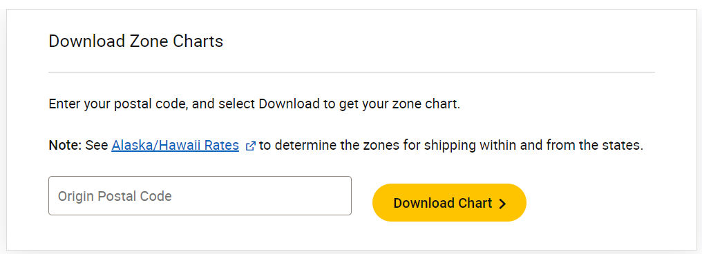
For UPS:
- Link: Download Zone Charts (UPS)
- Enter your postal code and select Download to receive your zone chart.
Note: For shipping within and from Alaska and Hawaii, please refer to the Alaska/Hawaii Rates to determine the applicable zones.
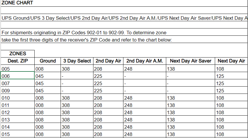
Example of UPS's Zone Chart: